Ka Lae, Ka'u, Hawaii
(south point)
 
The road to south point is some 7 miles west of the village of Naalehu and then you turn off the main circum-island highway 11 and go south for another 20 some miles. There to greet you will be tourists like yourself and pockets of locals with time to talk story and fish all day. This is the southernmost point in the USA and the point fabled to be that first reached by the Tahitians who over time became Hawaiians. This is speculation, however, based on the fact that if you are coming from Tahiti, the first island you are likely to see is the Big Island because of the 14,000 foot mountains and then because this south point would be the closest landfall. (pictures taken March, 2001)
Click on a picture below to blow it up!

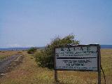
When you drive here this is the sign you will see in case you are lost. It also identifies Ka Lae as a National Historic Landmark. You will be able to drive all around this area on good but very narrow roads.

This is the main and only blinking beacon lighthouse type warning device for the south point in case you are a boat and haven't already recognized that there is land here. Note that the Kalalea Heiau is in front of it so the Hawaiians really had the idea first of putting a navigation marker at this location.

Kalalea Heiau is the Hawaiian alter and temple for this place. This picture is taken standing right inside the heiau looking south. There are no rocks in the center so I suppose they wanted to protect the wooden temple that would have been here for the priests inside these walls from the winds which can be quite strong in this open plain at the point.

Looking up the west side of the point, this is one of the most interesting aspects here. These are boat hoists that raise and lower boats into the water. They are modern versions of what was here in ancient times. You would think that it would be easier to just launch a canoe on the other side of the point where the land slopes gradually into the water, but apparently it is too difficult to drag the canoes and dragging them over the rocks gradually destroys them. People also jump off here but it is not advised because strong currents will carry you out to sea.

This is another picture looking east from the heiau at the point that gives you an idea of what the slope of the land is if you travel in this direction. Up the coast almost two miles in this direction is the fabled green sand beach that virtually every tourist who comes here hikes to.

Green Sand Beach is a wonderful hike to give you an idea of the feel of nature walking the coast of the big island where your viewing vistas are uninterrupted. Pictured here is the remaining inner wall of a volcanic cindercone whose seaside wall has washed out to sea. Youngters like to slide down the steep sand portion off the picture to the left. I believe you can see a hint of green in the sand in this picture. Close examination the remaining cliffside reveals flecks of a green crystal material in the black lava (not visible in the picture).